Stay Informed
Latest Notices
What's Happening
A Great Place To Call Home

Get In Touch with the RM Staff
The Rural Municipality of Rosser's Municipal Office is located on PR#221 in Rosser, Manitoba. Operating hours are: Monday to Friday, 8:30 a.m. to 4:30 p.m. For any general inquiries send emails to info@rmofrosser.com or call the Municipal Office at 204-467-5711. Mailing Address: 77E PR 221 Rosser, MB R4B 0C6.
If you are dropping off payment after hours, please use the drop box in the door. Payments can also be made online (Please see online payments for info)
Staff at the RM of Rosser Municipal Office are always there to assist you with any questions or requests you may have.
RM OFFICE STAFF
Larry Wandowich - Chief Administrative Officer
204-467-5711
cao@rmofrosser.com
Lori Sheldon - Municipal Services Manager
204-467-5711
assistant@rmofrosser.com
Trevor Wowk - Chief Financial Officer and Assistant Chief Administrative Officer
204-467-5711
cfo@rmofrosser.com
Kim King - Finance Officer
204-467-5711
finance@rmofrosser.com
Don Dowle - Special Project Coordinator
204-266-1050
Ashley Meyers - Executive Assistant (currently on Maternity leave)
204-467-5711
admin@rmofrosser.com
Leslie Snell - Accounts Payable and Payroll Administrator
204-467-5711
accounts@rmofrosser.com
Kelly Dyck - Office Assistant (acting Executive Assistant)
204-467-5711
officeassistant1@rmofrosser.com
Lana Gabbs - Office Assistant
204-467-5711
officeassistant2@rmofrosser.com
Susan Manchulenko - Clerk
204-467-5711
Calin Rogocki - Clerk
204-467-5711
PUBLIC WORKS
Jeff Harris - Public Works Foreman
pwforeman@rmofrosser.com
UTILITY
Larissa Derlago - Utility Lead Operator
utility@rmofrosser.com
Shawn Stewart - Utility Operator
utility@rmofrosser.com
BY-LAW
Sophie Skierszkan - By-law Enforcement Officer - sophie.skierszkan@sipd.ca

Living Here

News & Announcements
Recreation

CentrePort Canada
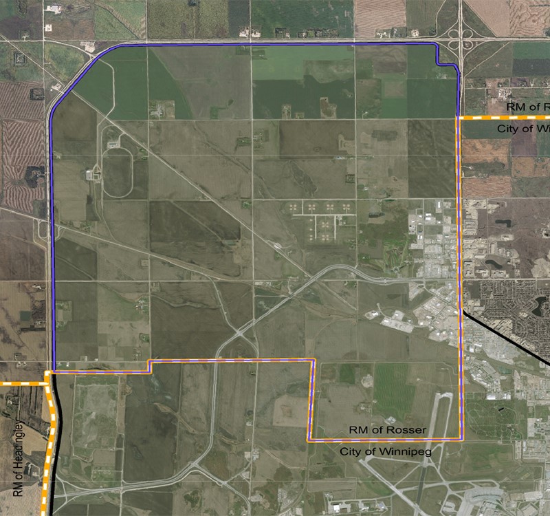
Map of Rosser

Online Permits